Saturday, March 30, 2013

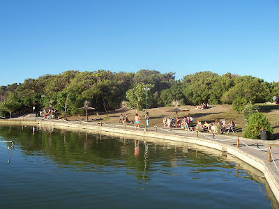
Pinamar beach

Pinamar is an Argentine coastal resort town located on the coast of the Atlantic Ocean in Buenos Aires Province. It has about 20,000 inhabitants as per the 2001 census.

Located less than 400 km (249 mi)south of Buenos Aires, it is one of several small seaside communities that line the coast. Since Pinamar's main attraction is the ocean, it is a fairly quiet town during the winter months. Tourism is what fuels the economy during the summer.


Two facts set Pinamar apart from most of the other Atlantic Ocean beach cities: it is a planned city with a very strict building code, and it has been artificially turned from wild sand dunes into a forest (mostly of pine trees, which explains the "pina" in the name).


City planning, as defined by founding architect Jorge Bunge and maintained by elected authorities ever since, translates into a city mostly made up of residential houses with open gardens; that, together with the pine forest, combine to make the city a very nice setting. That explains why it has been chosen as the summer resort for many well-to-do Argentinians, in particular those living in Buenos Aires.

Pine planting was originally started in Cariló -- a town nearby Villa Gesell and copied in Pinamar, although the city plan for Villa Gesell was not as carefully laid out or kept through the years.


Friday, March 29, 2013

Transportation Of Mar del Plata


Mar del Plata is served by Ástor Piazzola International Airport (MDQ/SAZM) with daily flights to Buenos Aires served by Aerolíneas Argentinas and Sol Líneas Aéreas and weekly flights to Patagonia served by LADE.

It has a bus terminal serving most cities in Argentina. There is a train station with two daily trains to Buenos Aires' Estación Constitución.

Highway 2 connects Mar del Plata with Buenos Aires and Route 11 connects it through the coastline, ending at Miramar, 40 km (25 mi) south of Mar del Plata. Route 88 connects to Necochea) and Route 226 to Balcarce, Tandil and Olavarría.

Thursday, March 28, 2013

Rada Tilly beach

Rada Tilly is a town in Escalante Department, Chubut Province (Patagonia), Argentina. The town is between Punta Piedras hill to the north and Punta del Marqués to the south. Punta del Marqués, a geographical landmark on San Jorge Gulf, reaches a height of 167 metres (548 ft), and extends into the sea for 1.5 kilometres (0.93 mi).

The area was first populated at least 9,000 years ago, and was first recorded by Captain Robert FitzRoy during his voyage on the HMS Beagle in the early 1830s (best known for its impact on the naturalist Charles Darwin). The municipality was established on July 24, 1948, as part of a nature conservation effort in the area during the administration of President Juan Perón. It was named for the Marquess Francisco Everardo Tilly y Paredes, a captain of the Spanish Armada who defeated Portuguese forces on the Río de la Plata, in 1795; Rada is "roadstead" in Spanish. The municipality is home to a growing population, which reached 6,208 in the 2001 Census, and has doubled every decade since 1980; its estimated population, per the provincial statistical bureau, was 9,226 in 2008. A beach resort city, Rada Tilly became one of the main recreational spots for visitors from nearby Comodoro Rivadavia, a city 13 kilometres (8.1 mi) to the north.


The main attraction of the city is its coastline, extending for 4.5 kilometres (2.8 mi), covered in fine sand. This uninterrupted geographical feature allows for the enjoyment of numerous leisure activities such as football, beach volleyball, and walking, as well as windsurfing, kitesurfing, diving, snorkeling, trekking, motocross, and mountain bicycling. Landsailing (three-wheeled carts with a sail attached to them that move with the force of the wind) is a popular spectator sport in Rada Tilly, and the 2008 Landsailing World Cup was held on these beaches.

Rada Tilly is also a popular fishing destination, and the wide range of fish includes salmon, hake, and sea bass, among others.


Wildlife and vegetation

From the look out point on Punta del Marqués, opened at the site in February 1986, a natural reserve for sea lions can be observed. The males are dark brown, and are distinguishable from the females by their manes and larger size; females calf from the last days of December to the last days in January. Other fauna include oysters and seagulls, which frequent the area's coast to feed.

Among the variety of flora found along Punta del Marqués, local species such as: uña de gato, zampa, adesmia, malaspina, duraznillo, and coiro predominate.


Wednesday, March 27, 2013

History of Mar del Plata


Pre-Spanish era: The region was inhabited by Günuna Kena nomads (also known as northern Tehuelches). They were later (after the 11th century) strongly influenced by the Mapuche culture.

1577–1857: First European explorers. Sir Francis Drake made a reconnaissance of the coast and its sea lion colonies; Don Juan de Garay explored the area by land a few years later. In 1742, during the War of Jenkin's Ear, eight survivors of HMS Wager, part of Admiral Anson expedition, and led by Isaac Morris, lived through a ten-months ordeal before being decimated and captured by the Tehuelches, who eventually handed them to the Spaniards. After holding the Englishmen as prisoners, they returned Morris and his companions to London in 1746.[13] First colonization attempt by Jesuit Order near Laguna de los Padres ended in disaster (1751).

1857–1874: The Portuguese entrepreneur Coelho de Meirelles, taking advantage of the country’s abundance of wild cattle, built a pier and a factory for salted meat, but the business only lasts a few years.

1874–1886: Patricio Peralta Ramos acquired the now abandoned factory along with the surrounding terrain, and founded the town on February 10, 1874. Basque rancher Pedro Luro bought a part of Peralta Ramos land for agricultural production. First docks also erected around this time.


1886–1911: The railway line from Buenos Aires, built by the Buenos Aires Great Southern reached Mar del Plata in 1886; the first hotels started their activity. The upper-class people from Buenos Aires became the first tourist of the new born village. They also established a local government that reflected their conservative ideals. Build-up of a French style resort.

1911–1930: The residents, mostly new arrived immigrants from Europe, demanded and obtained the control of the Municipality administration. The socialist were the mainstream political force in this period, carrying out social reforms and public investment. The main port was also built and inaugurated in 1916.

1930–1946: A military coup reinstated the Conservative hegemony in politics through electoral fraud and corruption, but in the local level they were quite progressive, their policies viewed in some way as a continuity of the socialist trend. The seaside Casino complex opened in 1939, was designed by architect Alejandro Bustillo, and Highway 2, the main road to Buenos Aires, also dates from this period.

1946–1955: Birth of the Peronist movement. A coalition between socialists and radicals defeated this new party by a narrow margin in Mar del Plata, but by 1948 the Peronism will dominate the local administration. The massive tourism, triggered by the welfare politics of Perón and the surge of the middle class marked a huge growth in the city’s economy.


1955–1970: After the fall of Perón, the socialists regained the upper hand in local politics; the city reached the peak in activities like construction business and building industry. Massive immigration from other regions of Argentina.

1970–1989: Slight decline of tourism demand, counterbalanced by the increasing of other industries such as fishing and machinery. General infrastructure renewal under the military rule. The centrist Radical Civic Union becomes the main political force after the return of Democracy in 1983.

1989–Present: Though the Peronism replaced the radicals in central government amid a national financial crisis, the latter party continued to rule in Mar del Plata. Some resurge of mass tourism in the early '90s was followed by a deep social crisis in town, with an increase of poverty, jobless rate and emigration. By contrast, the first decade of the 21st century shows an amazingly quick recovery in all sectors of the ailing economy.

On November 2005 the city hosted the 4th Summit of the Americas.

Villa Gesell beach

Villa Gesell is a seaside village in Villa Gesell Partido, Buenos Aires Province, Argentina. It was founded in 1931, afforestating a dune field. The growth of the city allowed it to annex the nearby cities of Mar de las Pampas, Las Gaviotas and Mar Azul.

History

The town is named after Carlos Gesell, the son of German economist Silvio Gesell. Carlos Gesell bought wood at Tigre for his business, and wanted to plant pines somewhere near Mar del Plata to reduce costs. Gesell was not planning to build a town at that point. Héctor Guerrero told him of 16.48 km2 (6.36 sq mi) of sand dunes on sale for 28,000 pesos, and Gesell bought them in 1931 when he checked for the existence of groundwater in the area. The coastline was 10 km (6.21 mi) long. He immediately began to forest the area, and built a house for himself in 1932. This house is now a municipal museum.

The forestation work did not proceed as expected: the strong saline winds moved the sand and harmed the plants, exposing and drying their roots. Gesell hired German agronomist Carlos Bodesheim in 1934, who could not find a solution. He then implemented two new ideas. First, he planted a high number of beneficial weeds, capable of surviving in the dunes, in order to anchor the sand in place. He planted trees with tubed roots, so that the roots sought water deeper in the ground and the wind could not tear them. Losses were still high, but decreasing. In 1938 he learned about the Australian Acacia longifolia, which was well adapted to the sand and the saline winds, and increased the ratio of nitrogen fixation. The Acacia was a success, and he arranged the plants so that the Acacias protected the pines from the wind.


Carlos Gesell lived permanently in the area from 1937 on. He began to run out of money in 1940, so he built a small timeshare named "La Golondrina" (Spanish: The swallow). The first tourists were the the Starks. Mr. Stark was manager of the local branch of the Siemens corporation. The Starks promoted the town back in Buenos Aires, and more tourist accommodations were built. The town was linked to Provincial Route 11 in 1943.

With new houses for tourists and the local population, the area was turned into a proper urban settlement, so Gesell began to see after the needed urban services, such as the supply of food, electric power, gasoline and a car workshop. He banned alcoholic beverages, cigarettes and any other things he deemed as a vice. He strongly opposed the establishment of a local casino, which was finally established at the nearby town of Pinamar. The city saw a large European immigration during World War II, who built the first hotels and themed restaurants. Most Italians worked as construction laborers, and most Spaniards administrated the shops and hotels. Urban development grew even more in the 1960s, as people that bought land and built houses in six months or less were refunded half the of the land's original price.

The settlement gradually expanded stretching along the coastline, and today continues it's growth has annexed three more towns to the south, namely, Mar de las Pampas, Las Gaviotas and Mar Azul. Villa Gesell has been a popular tourist destination since the 1940s.

In recent years Villa Gesell was known as a touristic destination for teenagers, but the current administrations seek to change this and aim instead for mature tourists. The "Gesell Rock", an annual rock festival, is not celebrated anymore, replaced for family-oriented musical shows.

San Clemente del Tuyú beach

History
Noticed by Ferdinand Magellan in 1520, who gave nearby Cape San Antonio its name, Spanish authorities first surveyed the area in 1580. Led by reformist Governor Hernando Arias de Saavedra, his Guaraní staff christened the spot Rincón del Tuyú ("muddy corner"). First mapped by British Jesuit Thomas Falkner in 1744, the neighboring stream was named San Clemente by Spanish Jesuit José Cardiel.
The San Antonio lighthouse, built in 1890.
Dunes on the San Clemente del Tuyú shore.

The waterfront area was soon purchased by the Ortiz de Rozas family, one of Argentina's most well-established landowners. Sold to another prominent family, the Leloirs, in 1816, the area became a sheep ranch. A descandant of the Ortiz de Rozas', General Juan Manuel de Rosas, had the area incorporated into a district of the Province of Buenos Aires in 1825, the area's first assigned jurisdiction since national independence in 1816; as Governor, Rosas brutally repressed a local insurrection in 1839 against his repressive rule. Following Rosas' 1852 overthrow, the area was given a county seat (Mar del Tuyú) in 1864 and, with the arrival of abattoirs, the government had fishermen's docks, a canal between San Clemente and Buenos Aires, a railhead and two lighthouses built between 1878 and 1902.

Prospering during the 1920s, the Argentine middle class first became widely aware of the idyllic coast through the efforts of Mayor Jorge Gibson, who had the local coastline graded into public beaches. The project's success led to the first gravel road into San Clemente in 1932 and its formal designation as a municipality; soon followed service stations, campgrounds, real estate developments, a power plant and even a monastery. President Juan Perón made plans for a nearby submarine base that, though never built, resulted in a four-lane highway into San Clemente. This and continuing national prosperity led to the town's rapid development after 1950, which led to the establishment of a hospital in 1970 and of Mundo Marino in 1979, still the largest oceanarium in South America.

A nature theme park (Parque Bahía Aventura) opened in 1997; drawing few crowds, the area was slated for closure when, in 2003, mineral hot springs were discovered at the spot. County Mayor Juan de Jesús set aside part of Bahía Aventura and opened Termas Marinas, today one of Argentina's most popular hot springs.


The city today

San Clemente del Tuyú, the northernmost among seven sea-side communities in the Partido de la Costa district, today counts 27 hotels (of which 14 are three or four-star establishments), the most important of which is the four-star sea-front Hotel Fontainebleu, with 71 rooms. The aquarium, adventure park and hot springs are complemented by two natural sciences museums, fishing boat tours and the 129 meter (400 feet) -long pier, among other parks and attractions. Punta Rasa, at the northern end of the city and the cape, was made a nature preserve in 1997. The activity around fishing boat tours centers around the black corvine feast held annually since 1966, towards December. The area's vast dunes also set the stage for the annual Enduro competition held here every February since 1998. A small but loyal contingent of visitors also arrives seasonally from San Clemente, California, a sister city of San Clemente del Tuyú since 1969.


The seven sister communities receive nearly a million visitors monthly during the peak summer season (January and February), of which San Clemente del Tuyú hosts roughly one tenth, given its proportion of the district's hotel room availability. A considerable number of summertime visitors also come to enjoy Benedictine monk Mamerto Menapace's sermons and lectures, which takes place at the order's San Clemente estancia and offers ascetic "pilgrim" accommodations. San Clemente del Tuyú hosted the Sixth Iberoamerican Congress on Environmental Education in September 2009.

Puerto Madryn beach

Puerto Madryn (in Welsh, Porth Madryn) is a city in the province of Chubut in the Argentine Patagonia. It is the head town of the Biedma Department, and has about 57,571 inhabitants according to the last census in 2001.

The town was founded on July 28, 1865, when 150 Welsh immigrants who came in the clipper Mimosa named the natural port Porth Madryn in honour of Sir Love Jones-Parry, whose estate in Wales was named "Madryn". The settlement grew as a result of the building of the Central Chubut Railway by Welsh, Spanish and Italian immigrants. This line, opened in 1888, linked it to Trelew via the lower Chubut River valley. Puerto Madryn is protected by the Golfo Nuevo, which is formed by Península Valdés and Punta Ninfas. It is an important centre for tourists visiting the natural attractions of the Península Valdés and the coast.


A new mall in the city center has helped tourism significantly, making Puerto Madryn a more attractive place for both international and domestic tourists visiting Patagonia. It is twinned with Nefyn, a small town on the Llŷn Peninsula in North Wales, result of its great link with Welsh culture since the Welsh settlement in Argentina. The first of a two-Test tour to Argentina by the Wales national rugby union team was played in 2006 in Puerto Madryn, a 27–25 win for Argentina. Puerto Madryn is home to two football clubs; Club Social y Atlético Guillermo Brown, who play in Torneo Argentino A and Deportivo Madryn that currently play in Torneo Argentino B.


A basketball team, Deportivo Puerto Madryn plays in the Liga Nacional de Básquetbol (LNB). Their home arena is known as the Deportivo Puerto Madryn Arena.

El Tehuelche Airport is located 10 km northwest of the downtown. Commercial flights from Buenos Aires, Ushuaia and other Argentinian cities are available. Most tourists fly in the Trelew airport as flights are restricted into Puerto Madryn due to environmental concerns.

Geography and Climate

Puerto Madryn can be found in Chubut on the Golfo Nuevo, which is formed by the Valdes Peninsula and Punta Ninfas. The climate is a temperate semidesert, with an annual precipitation between 150 and 200 mm.


Necochea beach

Necochea is a port city in the southwest of the province of Buenos Aires, Argentina, located on the Atlantic coast, on the edge of the Quequén Grande river, 528 km (328 mi) from Buenos Aires City and 120 km (75 mi) southwest from Mar del Plata. It has 89,000 inhabitants as per the 2001 census and it is the seat of government for Necochea Partido, a partido of Buenos Aires Province. On the mouth of the Quequen river, the port of Quequen, one of the most important ports in Argentina, is the gateway for the agricultural production of the southeast of the Province of Buenos Aires.
The majority of inhabitants of Necochea are Argentines, but throughout the years a large number of Danes have settled there. There are smaller "pueblos" or communities in Necochea mainly founded by Danes and other Nordic settlers.
  
Settlements
  • Quequen
  • Juan N.Fernandez
  • Nicanor Olivera (Est. LaDulce)
  • Claraz
  • Ramon Santamarina
  • Balneario Los Angeles
  • Costa Bonita


Monday, March 25, 2013

Tourism and Cityscape of Villa Gesell

Being a coastal city, the main tourist attraction in Villa Gesell is the beach. The Villa Gesell beach is 10 m (33 ft) long, with a soft slope, and a variety of spas built alongside; the annexed cities of Mar de las Pampas, Las Gaviotas and Mar Azul extend the beachside to 21 m (69 ft). The city has a staff of 150 lifeguards.

There is a lighthouse 30 m (98 ft) to the south, surrounded by a forest; some houses organize adventure tourism visit to the forest. It is the second highest lighthouse in the coast of the Buenos Aires province, second only to the one in Bahía Blanca. The area around the lighthouse works as a natural reserve as well.

The city has a zoo, a golf field, a market of crafts and many discos.

Villa Gesell and Pinamar, both tourist cities, have a regional rivalry about the type of tourist trade they cater to. Pinamar aims for wealthy Argentine tourists, while Villa Gesells aims for those in the middle class. Prices in Villa Gesell are lower, but crime is higher.


Villa Gesell is built parallel to the coastline, along a main avenue. The architecture has a mix of styles, with buildings of different sizes, shapes and colours. The urban development at the beaches proved to be harmful for nature, as the beach became gradually smaller each year. The city sought to revert this effect, and when the franchises of each spa began to expire, they were not renovated. The buildings made with bricks and concrete were demolished, and replaced with smaller buildings made of wood. Automobile traffic was banned next to the beach, and each beach lease was allowed a maximum of 80 tents.